TomoScand 3D
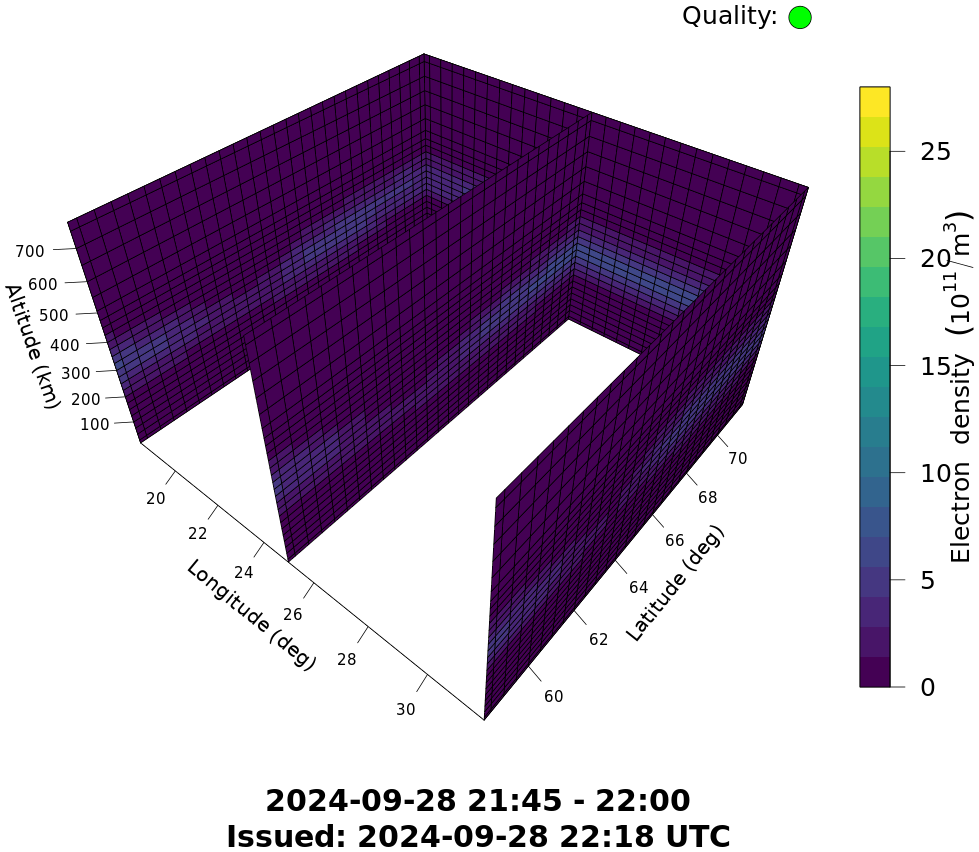
The TomoScand3D product shows a volumetric image of electron density in the altitude range of 100-800 km. The product is updated once per 15 min. The TomoScand3D product shows a volumetric image of electron density in the altitude range of 100-800 km. The product is updated once per 15 min. Numeric electron density values and inversion quality information are available as JSON file whose format is described under the Product Description link in the navigation bar. The TomoScand inversion uses dual frequency signals from the Global Navigation Satellite Systems as input . GNSS signals are received by a set of stations in the EUREF Permanent GNSS network and the IGS network (see map of receivers under Product Description link in the navigation bar). A priori information for the inversion is acquired from dynasondes in Tromsø (by the EISCAT Association) and in Kiruna (by Swedish Institute of Space Physics). The reference coordinate system is WGS84.