Climate change, driven by increasing atmospheric concentrations of anthropogenic greenhouse gases (GHGs), is one of the greatest threats of our time. Space-based observations offer new opportunities for improving the completeness and transparency of emission reports as they provide objective observations over areas where other information is inaccurate or not available.
Over the past decade, satellite-based measurements of greenhouse gases have transformed the estimation of emission rates from anthropogenic hotspots. New satellite observations of emission plumes from point sources have created opportunities to use simpler and more computationally efficient methods for estimating emissions. International accords like the 2015 Paris Agreement have played a major role in driving research in this area. Many space agencies, organizations, and private companies are now developing new GHG satellite missions and constellations to observe plumes and support future monitoring of GHG emissions.
To obtain emission estimates from atmospheric concentrations, mathematical inverse modeling methods are needed. The Finnish Meteorological Institute is dedicated to developing new methods for data-driven emission estimation that do not require complex atmospheric modeling. In particular, the team has developed several new plume inversion techniques for various recent satellite missions. As part of user engagement activities, the team has piloted a new service for the African continent, where ground-based information has traditionally been less available.
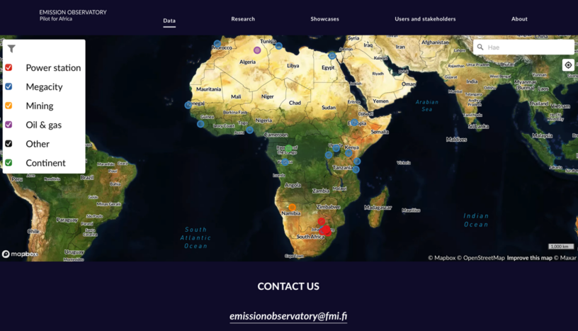
The Emission Observatory – Pilot for Africa platform is an interactive map service for monitoring anthropogenic GHG and air pollution hotspots in Africa using satellite observations and state-of-the-art emission estimation methods. Specific focus areas include cities and megacities, the mining sector (particularly critical minerals needed for the green transition), energy production (e.g., power plants in South Africa’s Highveld region), and the oil and gas industry (especially regarding fugitive methane emissions and gas flaring). The service is set to inform decision makers, environmental authorities, citizens and industry about emission sources and their spatio-temporal variability, specifically over the African continent. The information provided through the platform are tailored to the users’ needs and feedback. The platform is based on publicly available observations from the EU’s Copernicus Sentinel fleet and NASA’s Earth observation program.
User and stakeholders of the Emission Observatory – Pilot for Africa service can engage and participate in the service implementation through a co-design process.
More information
If you are interested in and would like to benefit from this service and methods, please contact us: emissionobservatory@fmi.fi
Link to the service: https://www.emissionobservatory.org


Leave a Reply
You must be logged in to post a comment.