
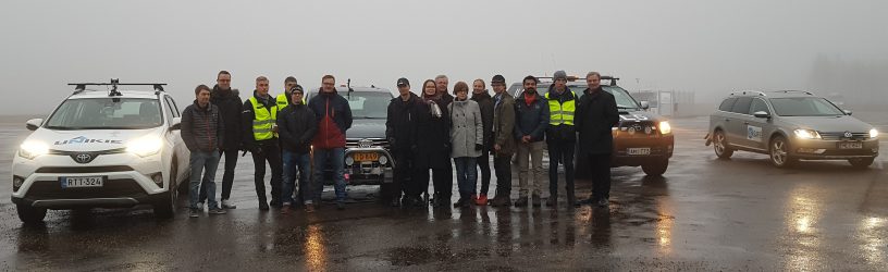
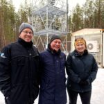
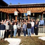
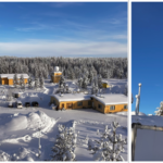
The 5G-SAFE project targets to exploit and challenge the enhanced capacity and properties of 5G communication with sophisticated services and procedures designed into the vehicle entity. We have developed new road weather and safety services and enhanced existing ones by exploiting extensive vehicular observation data. The examples of these new services were showcased in our final project demonstration event in 8.11.2018 at Sodankylä, in Finnish Meteorological Institute’s (FMI) instrumented winter testing track for road weather and 5G services.
The demonstrated services reflect the usage scenarios important to each partner. In the first demonstration, Finnish Meteorological Institute showcased 3 scenarios of road weather services offered directly to the vehicles, with the aid of 5G networking. Scenario 1 provides up-to-date road weather forecast related weather notifications in real-time to the vehicles. Scenario 2 issues warnings related to traffic incident (airbag burst in a vehicle) and scenario 3 weather incident warnings of slippery roads. These services are also delivered to vehicles in real-time, with robust 5G networking. Scenario 3 friction observations are also part of the 5G services, the vehicular measurement data is collected in real-time from a specific truck fleet gathering in-situ observations from public road.
Demo 2 was also composed by FMI. It focused on vehicle-to-vehicle video transmission, which we have envisioned to be beneficial in cases we have observed drifting snow on the road and therefore limited visibility in queues of vehicles. Vehicle camera data is delivered from vehicle-to-vehicle from the leading vehicle to the queue, allowing all vehicles prepare for the conditions and events ahead. Thanks to 5G communication capacity, this kind of services are enabled.
Demo 3 consisted of several road maintenance scenarios presented by Destia, FMI and FMI services. FMI introduced the concept of snowy traffic sign recognition, and FMI services snow ploughing timing model assisted by real driving data from the ploughing vehicles. Jalonne presented road condition analysis by vehicular application integrated into mobile phone, and Destia provided unbalanced road surface recognition.
In the final Demo 4 VTT’s robocar was driving autonomously in the test track, changing preferred route by obstructive object observations provided by Unikie’s Lidar-system and FMI’s friction warnings.
More information:
Dr. Timo Sukuvaara, timo.sukuvaara@fmi.fi
5G-Safe web-pages: http://5gsafe.fmi.fi/
Leave a Reply
You must be logged in to post a comment.