
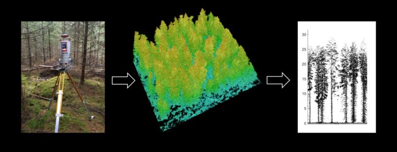
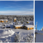
A group of researchers, including Co-operative (UH-FMI) Professor Eduardo Maeda, investigated the structural differences in boreal forests under different managements. The study included even-aged and uneven-aged stands in southern Finland that were measured using terrestrial laser scanning (TLS). From the hyper detailed 3D point cloud derived with TLS, structural characteristics can be measured in ways that have not been possible with traditional field inventories.
The management types produced significant differences in the vertical allocation of plant material. In even-aged stands, the canopy and the understory layers could be distinguished more clearly than in the uneven-aged stands, where plant material was more evenly distributed along the vertical profile. Uneven-aged stands also showed more horizontal heterogeneity in terms of canopy layering, whereas in even-aged stands the heterogeneity increased with stand age. The results highlight the dynamic nature of even-aged forests compared to uneven-aged stands that are more stable over time.
Quantifying forest 3D structure is necessary for improving the understanding of how forest management is affecting microclimate and habitat availability, which are important determinants of biodiversity.
Further information:
Iris Aalto, Doctoral researcher, University of Helsinki, iris.aalto@helsinki.fi
Juha Aalto, Research professor, Finnish Meteorological Institute, juha.aalto@fmi.fi
Scientific article is available in Forest Ecology and Management.
Reference: Aalto, I., Aalto, J., Hancock, S., Valkonen, S. & Maeda, E.E. Quantifying the impact of management on the three-dimensional structure of boreal forests, Forest Ecology and Management, Volume 535, 2023, https://doi.org/10.1016/j.foreco.2023.120885.

Leave a Reply
You must be logged in to post a comment.